The mobile network with the worst signal in Nottinghamshire

Key Points
- Three had the largest areas of no and poor coverage in Nottinghamshire, with EE best overall
- FarrPoint surveyed 4,728 km of roads for the county council between March and July 2026
- 228 km of roads (4.8%) had poor coverage from every operator, and 27 km had almost none
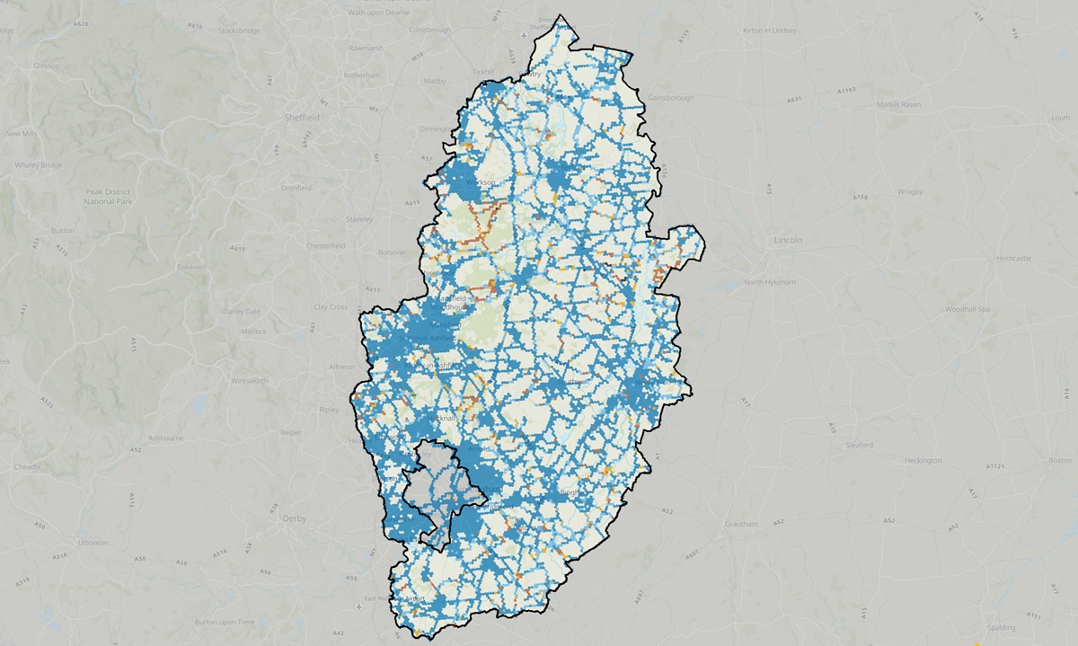
- Residents can now check coverage by postcode on a new interactive public map
Three recorded the largest areas of no coverage and poor coverage across 4,728 km of Nottinghamshire roads, according to a survey published by connectivity consultancy FarrPoint on Tuesday (15 September).
Nottinghamshire County Council commissioned FarrPoint to carry out the survey between March and July 2026, covering motorways, main A and B roads, local roads and smaller rural routes.
Instead of relying on the predicted coverage maps that mobile operators publish, the survey measured actual signal strength and resident experience on the ground.
FarrPoint combined signal strength, download and upload speeds and latency into a single Coverage Performance measure to reflect the service a mobile user would experience.
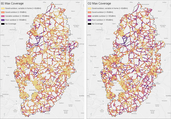
On that measure, Three had the largest areas of no coverage and poor coverage, followed by O2 and Vodafone, while EE recorded the best coverage overall.
The survey found that 228 km of roads, or 4.8% of those surveyed, had poor coverage from all four operators. Around 27 km, or 0.6% of the total, had particularly poor outdoor coverage from every operator, meaning residents are unlikely to make voice calls or get a usable mobile service in those areas.
New public coverage map
FarrPoint used the results to build an interactive online map for residents. Users can search by address or postcode to see what coverage is like in their area and compare the performance of the different operators.
The map uses a colour-blindness-friendly colour scheme so that as many people as possible can read the information.
“This map is vital as we want to make sure our residents and businesses are as well connected as possible and can access accurate information about which mobile phone operators perform best where they live, work and travel,” said Bert Bingham, Cabinet Member for Transport and Environment at Nottinghamshire County Council.
Bingham said many residents need a strong mobile signal for accessing healthcare services, operating smart meters, charging electric vehicles and shopping online, particularly those who cannot get out and about.
He added that the project gave the council a clearer understanding of where improvements may be needed, especially in rural areas with potential gaps in coverage.
“Reliable mobile services matter for everyday life, from keeping in touch with family and accessing online services to helping people stay connected in an emergency,” said Chris Bond, Head of Data at FarrPoint.
Bond said the council could use the data to identify areas at greater risk of digital exclusion and to inform future policy, planning and investment decisions.
FarrPoint said its mobile coverage mapper is an autonomous network monitoring tool that records real-world rather than modelled performance for all available networks, and that it has deployed the system across the UK and Canada.